
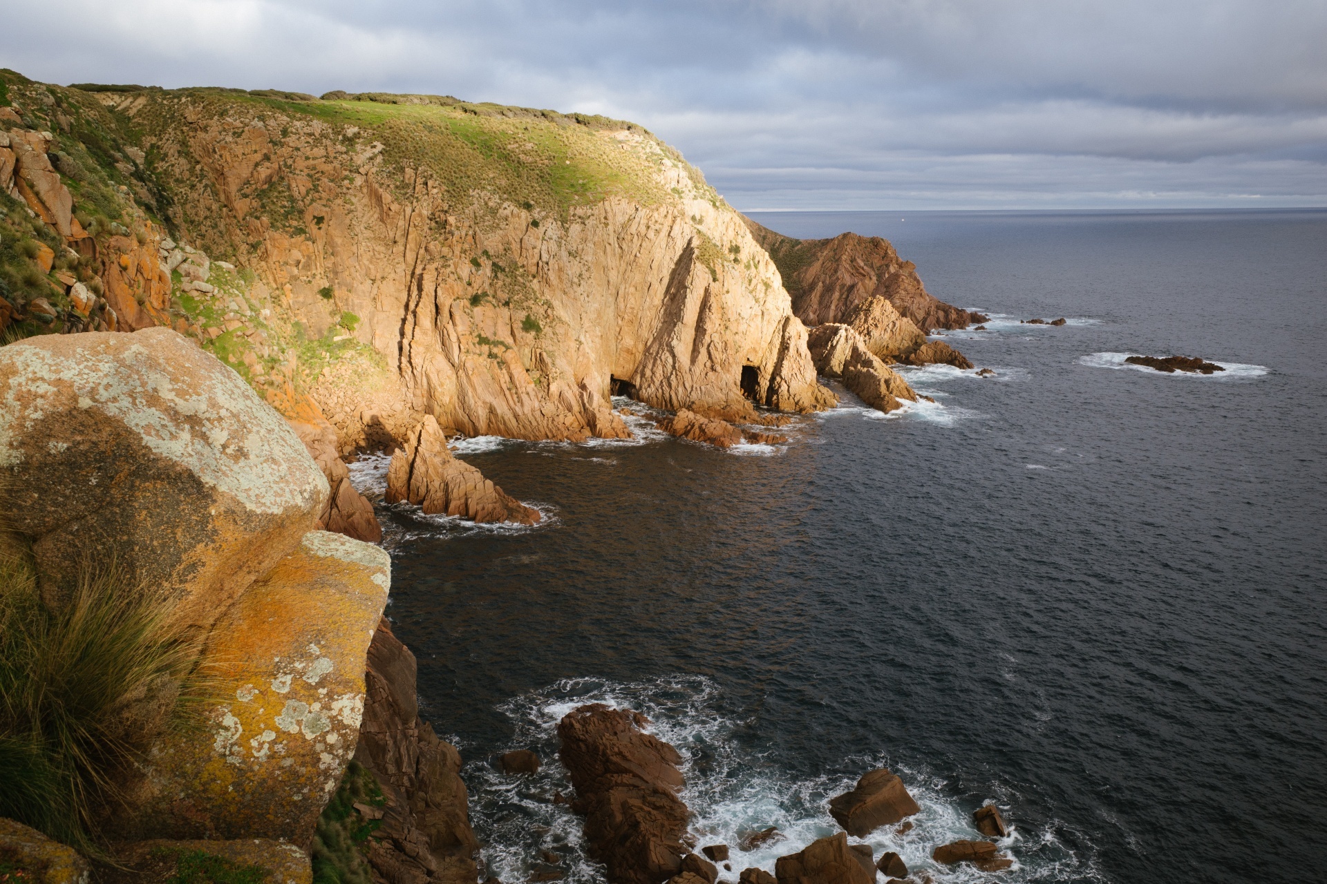
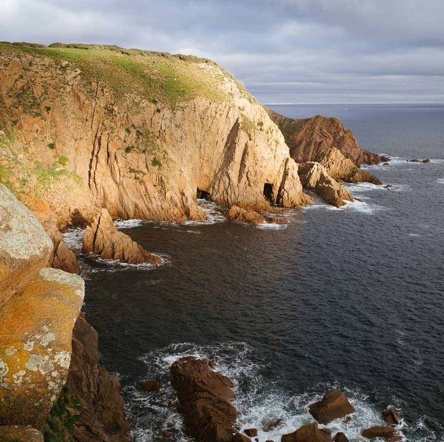
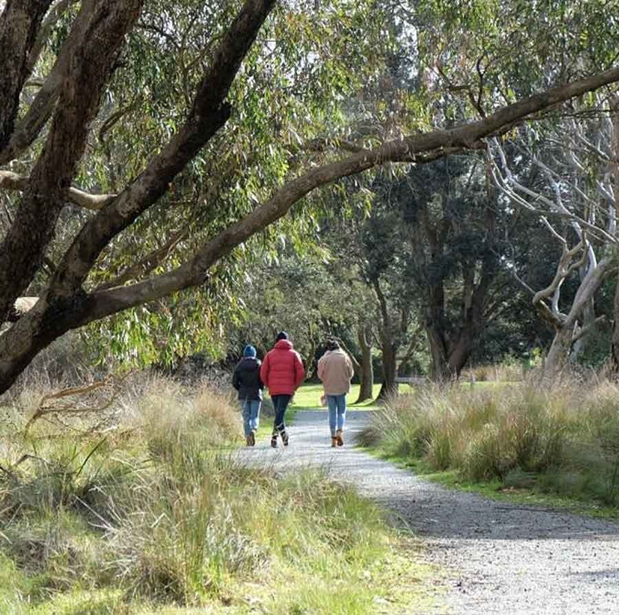
Cape Woolamai Walking Trails
Dificulty: Moderate
Location: Woolamai Beach Road, Cape Woolamai, Phillip Island.
The Cape Woolamai Walk on Phillip Island is a must-visit for nature lovers and outdoor enthusiasts. The walk offers stunning views of the island's seascape, which changes with the weather and season. You can also spot various bird species, including shearwaters or muttonbirds, who dig tunnels to nest in the area.
Walks
Pinnacles Walk (follow green markers) - 4.5km return / 1½ hours walking return
Old Granite Quarry Walk (follow blue markers) - 6km return / 2 hours walking return
Cape Woolamai Beacon Walk (follow black markers)- 6.6km return / 2½ hours walking return
Cape Woolamai Circuit (this walk is a combination of all three walks) - 8km / 4 hours walking return
Getting There
Drive to the Cape Woolamai car park, where the walks start. It should take about 20 minutes to get from Cowes to Cape Woolamai.
From car park, walk on to the beach, turn left, follow beach for approx. 1km , then take stairs up to cliff top to loop walks.
Head southeast on Thompson Ave toward Chapel St.
Continue straight onto Chapel St.
Turn right onto Ventnor Rd.
Continue straight onto Phillip Island Rd.
Continue onto San Remo-Phillip Island Rd.
Turn left onto Cape Woolamai Rd.
Continue straight until you reach the Cape Woolamai car park.
It's about a 20-minute drive from Cowes to Cape Woolamai.
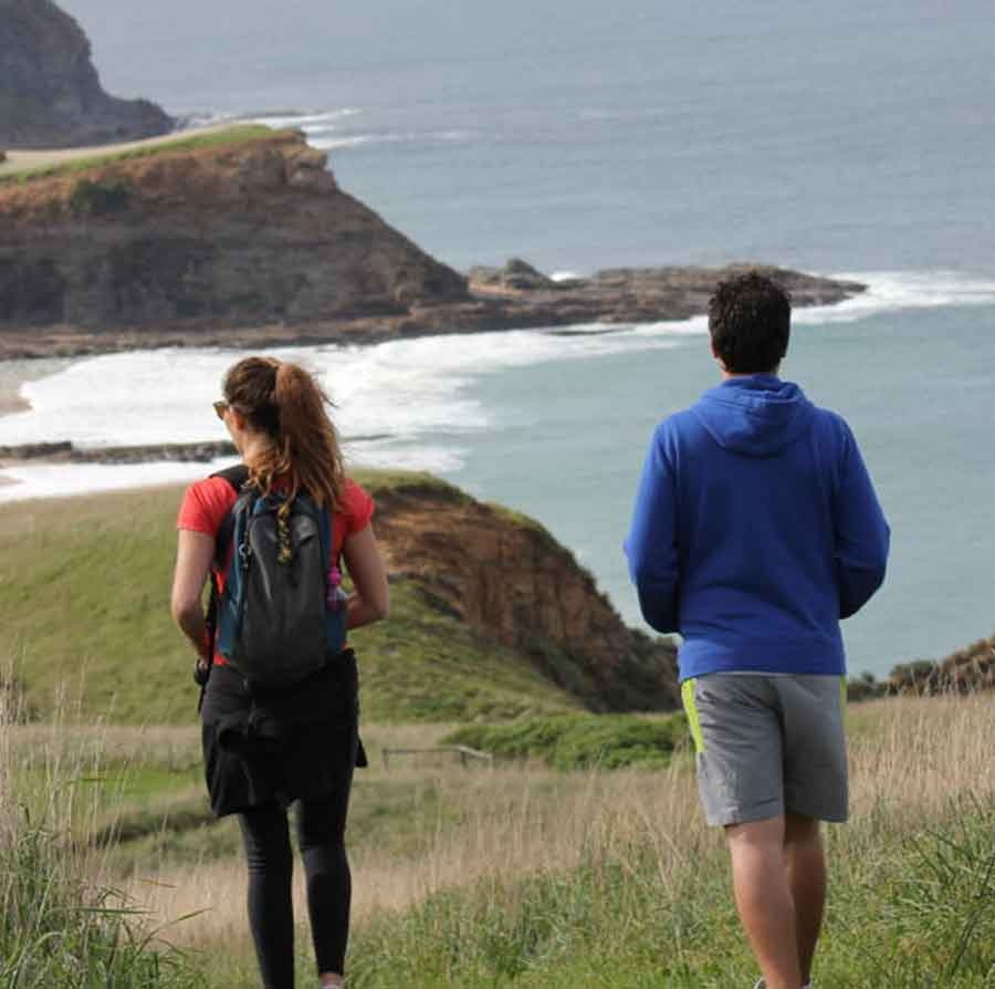
George Bass Coastal Walk
Dificulty: Moderate
Distance: 7km one way
Location: Southern end of the Punchbowl Road
The George Bass Coastal Walk is a popular trail that offers stunning panoramic views of the coast. This 7-kilometer walk starts from Punchbowl Road in San Remo and ends at the Bass Highway in Kilcunda, taking about two hours to complete one-way. The narrow path winds along the cliff tops, rising high above the crashing waves of Bass Strait.
The walk retraces the route of explorer George Bass on his journey of discovery along the southern edge of the Anderson Peninsula over 200 years ago. It requires an average level of fitness, with the use of stiles over farm fences along the way.
The George Bass Coastal Walk now links with the Bass Coast Rail Trail, making it possible to walk from San Remo to Wonthaggi. This is a great opportunity to enjoy the scenic beauty of the coast and learn about the history of the area.
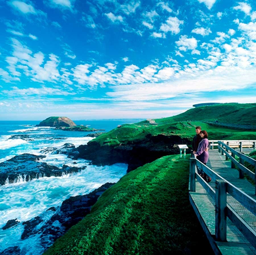
The Nobbies Walk
Dificulty: Easy
Distance: 500 Metres
Location: 1320 Ventnor Road
Wheely Friendly
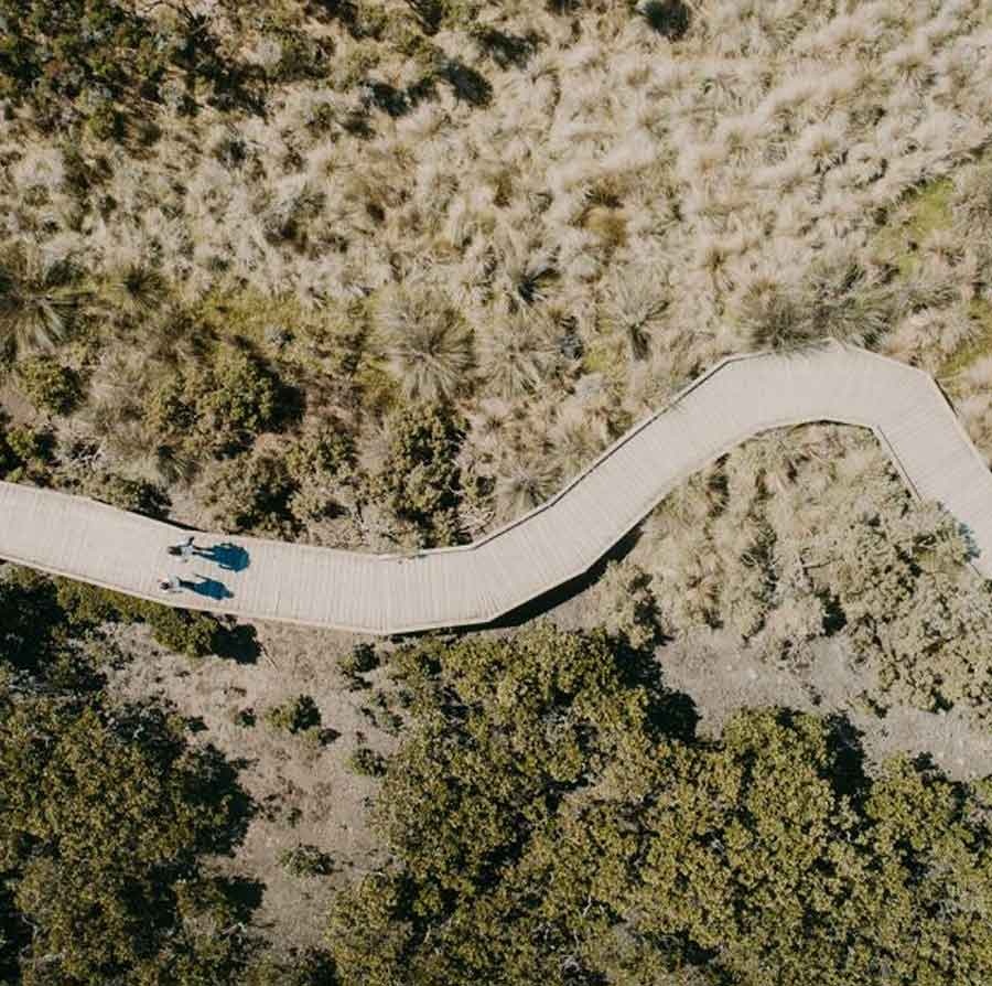
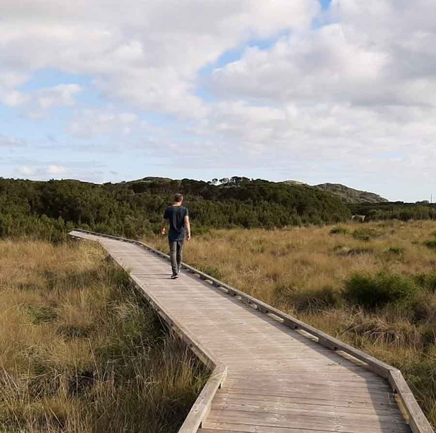
The Nobbies Walk is a popular coastal walk located on Phillip Island, Victoria, Australia. It offers views of the rugged coastline and the Southern Ocean. The walk starts from the Nobbies Centre and takes visitors along a boardwalk that winds through the coastal heath and over the rocks, providing panoramic views of the surrounding area.
Along the way, visitors can spot a variety of wildlife, including penguins, seals, and birdlife. The Nobbies is also home to one of the largest Australian Fur Seal colonies in the country, and visitors can observe the seals from a safe distance.
The walk is suitable for all ages and abilities, and is an easy, flat walk with a total distance of approximately 1.8 km return. The walk takes approximately 45 minutes to an hour to complete, depending on your pace.
Getting There
To get to the Nobbies Walk from Cowes, you can drive along the Phillip Island Tourist Road and follow the signs to the Nobbies Centre. Parking is available at the Nobbies Centre, and the walk starts from there. It is recommended to check the weather conditions before heading out on the walk, as the conditions can be quite windy and rough on the coast.
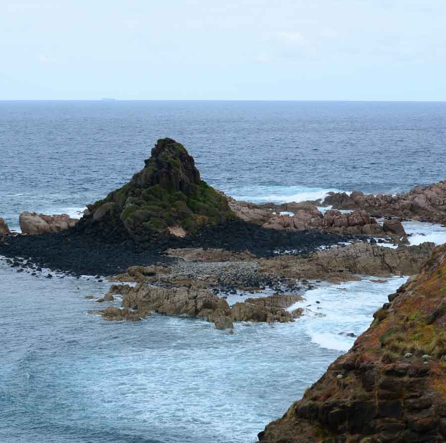
Pyramid Rock Walk
Dificulty: Easy
Distance: 800 Metres
Location: Pyramid Rock Road
Wheely Friendly
Pyramid Rock is a triangular rock formation located on the southern coast of Phillip Island. The Pyramid Rock Walk is a short and easy 800 meter round-trip trail that leads to a grassy point overlooking Pyramid Rock. Hikers can take in views of the coast from Cape Woolamai to the east to Point Grant to the west.
The walk starts from the end of Pyramid Rock Road, a gravel road leading to the southern shore of Phillip Island. A wheelchair-friendly boardwalk rises gradually for 200 meters, leading to the first overlook with a pair of benches. Take in the view of the ocean looking east along the coast to Cape Woolamai. The trail continues further out on the point to a second overlook, backed by a pyramid of dark rock rising out of the surf.
The trail is only wheelchair-friendly up to the first lookout. Afterward, the boardwalk continues with steps leading to the end of the point. Here, hikers can witness the waves colliding with the short sea cliffs and see all the way down the coast to the western tip of Phillip Island at Point Grant, also known as The Nobbies. In the distance, you'll also spot the Penguin Parade buildings at Summerlands Beach.
At the end of the trail, a staircase leads up to a wooden viewing platform offering views in both directions. In front of the overlook, you'll see a pronounced cone of dark earth in the ocean and Pyramid Rock, which is closed off for preservation. The view from the overlook alone is quite rewarding. Take some time to relax and watch the waves roll in around Pyramid Rock before returning to the trailhead.
The trail to Pyramid Rock is straightforward and well-defined, with no junctions along the way, and there are no fees or permits required. However, dogs are not allowed on the trail, and there are toilets available at the trailhead.
Rhyll Inlet Wildlife Reserve
Dificulty: Easy
Distance: 1200 Metres
Location: Car park at Cowes-Rhyll Road
Wheely Friendly
Embark on a journey of natural beauty and tranquility at the Rhyll Inlet Wildlife Reserve on Phillip Island. The reserve offers several walking tracks, ranging from easy to moderate, for visitors to explore its unspoilt wetlands.
Start your journey at the Conservation Hill car park on Cowes-Rhyll Road, where you can choose from three trails: the Green Loop, a short 30-minute return trip on the mangrove boardwalk; the Blue Loop, a 1-hour return trip to the Rhyll Inlet Lookout; or the Black Loop, a 1.5-hour return trip to the village of Rhyll.
The mangrove boardwalk allows you to experience the unique ecosystem of the mangroves, salt marshes, and tidal flats, which are recognized as important by the Ramsar International Wetlands Agreement. Along the way, you'll have the opportunity to observe a variety of migratory wading birds, such as spoonbills, oystercatchers, herons, egrets, and cormorants.
To get the best view of the wetlands, be sure to climb the Conservation Hill Observation Tower. And, if you're feeling peckish after your walk, head to the historical village of Rhyll, where you'll find cafes serving locally sourced food and drink.
The Rhyll Inlet and Wetlands Trail is wheelchair and pram accessible and is also suitable for bicycles. No permit or fee is required, so grab your camera and spend a day in this world-renowned habitat for migratory waders.

Kitty Miller Bay Shipwreck Walk
Dificulty: Moderate
Distance: 2km return
Location: Kitty Miller Bay Rd
Explore the stunning coastline of Kitty Miller Bay on Phillip Island with the Kitty Miller Bay Shipwreck Walk. On a low tide, the walk will take you around the headland and bay, offering breathtaking views of the ocean. The walk also offers a chance to see the site of the SS Speke shipwreck, which ran aground on the coast of Phillip Island in 1906.
The SS Speke was the second largest ship-rigged vessel ever built and its remnants can sometimes still be seen from the Kitty Miller Bay Walk. The ship ran aground due to poor navigation by the captain and the remnants serve as a reminder of its history. To fully appreciate the shipwreck, make sure to plan your walk for low tide, as access is limited at high tide.
Aside from the shipwreck, Kitty Miller Bay is also a great spot for snorkelling, swimming, and even surfing. Take in the beautiful coastal views while also enjoying water activities. Whether you're interested in the shipwreck or just want to take in the views, the Kitty Miller Bay Shipwreck Walk is an experience not to be missed.
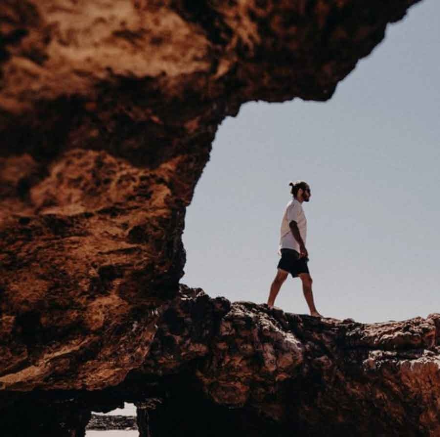
Forrest Caves Walk
Dificulty: Moderate
Distance: 2kn return
Location: Forrest Caves Car Park
Experience the beauty of Phillip Island's hidden gem - Forrest Caves. These sea caves, formed by years of erosion on the cliffs, are only accessible during low tide. Start your journey from the Forrest Caves car park and follow the steps down to the beach. On your way, you'll pass by towering sand dunes that serve as the home of thousands of short-tailed shearwaters from October to April.
At Forrest Caves, you can admire the intricate formations created by the erosive forces of the ocean. Be cautious of the changing tides and waves, and make sure to only explore the caves during low tide.
Scenic Estate Conservation Reserve
Dificulty: Easy
Distance: 1.5km
Location: Phillip Island Road
The Scenic Estate Conservation Reserve is a 28-hectare area of natural bushland on Phillip Island that was opened to the public in 2015. This site was developed through a collaboration between Bass Coast Shire Council, Phillip Island Nature Parks, Parks Victoria, and the State Government with the aim of preserving wildlife and improving the habitat for fauna.
Visitors to the Scenic Estate Conservation Reserve can enjoy stunning bay views of Churchill Island, Rhyll and beyond, as well as experience the diverse birdlife that inhabits the reserve. The site is home to six species of threatened birds and endangered grasslands and vegetation.
The reserve features 1500 meters of walking tracks and 195 meters of boardwalk through the native grasslands, a wetland area planted with indigenous plants, a viewing platform with panoramic views of the Ramsar-listed wetlands of Western Port and Churchill Island Marine National Park, two picnic shelters and seats, a car park, and interpretive signage that highlights the natural values of the site.
Swan Lake
Dificulty: Easy
Distance: 1.3km return
Location: Ventnor Road, Summerlands
The Swan Lake Trail is a short and easy walking path located on Phillip Island. The round trip distance of the trail is only 1.3 kilometres, making it a quick and enjoyable experience for visitors.
Swan Lake is home to various bird species, including black swans, cormorants, and purple swamp hens, making it a perfect spot for birdwatching. The trail features boardwalks that provide stunning views of the lake, and two bird hides are located near the edge of the lake, offering even better birdwatching opportunities.
This trail is ideal for those who want to enjoy a peaceful and scenic walk, or for those who want to observe the local birdlife. The trail is also suitable for wheelchairs and strollers.
It is important to note that Swan Lake is a significant site for the Bunurong/Boon Wurrung People and is located just before the entrance to the Penguin Parade.
